Do you have the Roadkill TAS App?
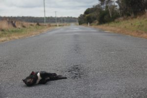
Sadly, the only Tasmanian devils many people have seen are those killed on our roads.
There is a real need for consistent data collection and an understanding of roadkill, as it is the second biggest threat to the survival of the Tasmanian devil after devil facial tumour disease (DFTD).
The new linking of data entered into the Roadkill TAS App with the LIST (Land Information Services Tas.) helps paint the bigger roadkill picture across the state – enabling us to clearly see how many animals are killed on our roads every year. (See this map).
This is important news because it helps better explain where roadkill hotspots are located on Tasmanian roads for all native wildlife.
During spring and summer the devil population swells as dispersing juvenile devils search for their own home range and this means more devils are out and about on the roads.
Reporting devil roadkill provides vital information and helps develop mitigation strategies. It also assists in efforts to monitor the spread of DFTD.
The Roadkill TAS App is free and easy to use and allows you to report roadkill incidents easily with the tap of a button.
The data available via The List spans several years and extra layers have been added to separate the data by type of animal and year – data is separated by colour (for the year) as well as by symbol (for the type of roadkill).
